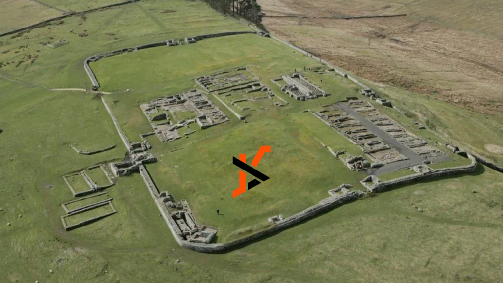
Archaeology, the study of past civilizations through the analysis of material remains, has entered a new era with the integration of modern technology and mapping innovations. The marriage of archaeology and cutting-edge mapping solutions has revolutionized the field, offering unprecedented opportunities for research, preservation, and public engagement.
What role does modern technology play in archaeology?
At the forefront of this transformation is the use of LiDAR technology, which employs laser pulses to create detailed maps of archaeological sites. This technology allows archaeologists to uncover hidden features of landscapes with remarkable precision, enabling them to conduct in-depth surveys that were previously impossible.
In addition, drones have become invaluable tools for aerial mapping and site analysis. By capturing high-resolution images from above, archaeologists can gain a bird’s eye view of their sites, facilitating detailed mapping exercises and enhancing their understanding of spatial relationships within the archaeological context.
Furthermore, the advent of 3D scanning and mapping technologies has revolutionized the preservation and research of archaeological artifacts and sites. By creating digital replicas of objects and structures, archaeologists can study and document them in intricate detail, ensuring their long-term conservation and enhancing research capabilities.
How do transformative mapping solutions benefit archaeological research?
One of the key advantages of these mapping innovations is the enhanced accuracy and precision they offer in mapping historical sites. By providing detailed and reliable data, archaeologists can create comprehensive site maps that serve as invaluable resources for their research and interpretation.
Moreover, these technologies enable efficient data collection, leading to faster analysis and insights. The streamlined process of gathering and processing data allows researchers to focus more on the interpretation and implications of their findings, accelerating the pace of archaeological research.
Additionally, the integration of Geographic Information Systems (GIS) into mapping solutions provides archaeologists with a powerful tool for organizing, analyzing, and visualizing spatial data, enhancing the comprehensiveness and depth of their mapping endeavors.
What are the challenges faced in implementing mapping technologies in archaeology?
Despite the transformative benefits of these mapping technologies, there are challenges that archaeologists face in their implementation. Cost constraints present a significant barrier, as acquiring and maintaining advanced mapping equipment can be prohibitively expensive, particularly for smaller research projects and organizations.
Technical expertise is another critical challenge, as operating and interpreting mapping data require specialized training and skills. Archaeologists may need to collaborate with experts in geospatial technologies to harness the full potential of these mapping solutions effectively.
Compatibility issues with legacy archaeological data and tools also pose a challenge, as integrating modern mapping technologies with existing datasets and workflows can be complex and time-consuming, requiring careful planning and coordination.
How can traditional archaeology benefit from modern mapping solutions?
Traditional archaeology stands to gain numerous advantages from embracing modern mapping solutions. Digital mapping offers improved site documentation and record-keeping capabilities, ensuring that valuable archaeological data is accurately preserved and easily accessible for future research and analysis.
Additionally, the availability of advanced tools has expanded beyond professionals, with aficionados and hobbyists now able to easily find a GPS rover for sale. This accessibility allows them to contribute meaningfully to community projects or independent research, further enriching the archaeological community with diverse data and insights. By integrating these modern technologies, both seasoned archaeologists and enthusiastic amateurs can enhance the precision and depth of archaeological exploration, fostering a collaborative environment that benefits the entire field.
Furthermore, the use of enhanced visualization tools allows archaeologists to present their findings in engaging and informative ways to the public. By creating immersive experiences and interactive displays, researchers can share their discoveries with a wider audience and foster greater appreciation for cultural heritage.
Collaborative platforms that facilitate the sharing of mapping data across archaeological communities promote knowledge exchange and collaboration, enabling researchers to benefit from diverse perspectives and expertise in their mapping endeavors.
What does the future hold for the integration of archaeology and mapping technologies?
The future promises exciting advancements in the integration of archaeology and mapping technologies. Artificial Intelligence (AI) is expected to play a significant role in automated site detection and mapping, streamlining the process of identifying and documenting archaeological sites with unprecedented speed and accuracy.
Virtual Reality (VR) applications offer immersive exploration opportunities, allowing users to experience archaeological sites in virtual environments and engage with historical narratives in interactive and educational ways. This technology has the potential to revolutionize how we perceive and interact with the past.
Moreover, the development of open-access mapping tools will democratize archaeological research, making valuable mapping resources more widely available to researchers, students, and the public. By fostering greater accessibility and transparency, these tools will contribute to the democratization of knowledge and the advancement of archaeological scholarship.

